
Yigeziya Fm
Type Locality and Naming
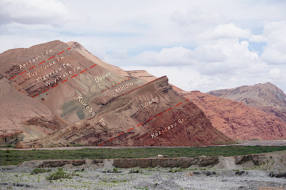
Western Tarim Basin. The Yigeziya Formation was erected by the No.107 team of the department of geological survey under the Xinjiang Petroleum Administration in 1976. The section for the designation is at Yigeziya about 20 km south of Yingisar county of Xinjiang.
Lithology and Thickness
The Yigeziya Formation is represented by purple gray and gray white massive limestone. It is 114 m thick. For outcrop photographs -- see Kukebai Fm.
Relationships and Distribution
Lower contact
Its conformable base marked by purple gray limestone is distinguished from brown red mudstone of the underlying Wuyitak Fm.
Upper contact
Its conformable top marked by gray yellow limestone is distinguished from light brown fine sandstone of the overlying Tuyiluoke Fm.
Regional extent
The present formation is distributed in the piedmont area of west Kunlun Mountain west of Yingisar and in Yigeziya, Tuyiluoke, Tamu, Qimugen, Abalike, Artashi, Heshilapu and Momoke southeast of Yingisar. In the Kuzigongsh area of southern Tianshan Mountain, it is built up by interbedded limestone, sandy limestone, mudstone and gypsum. On the frontal edge of the Kunlun Mountain, it decreases gradually in thickness from west to east and is 67 m in Artashi and only 35 m thick in Momoka.
GeoJSON
Fossils
The formation yields sessile clams such as Duramia sp., Sauvagesia sp.; in Artashi and Akcheyi it yields the foraminifera zone represented by Triloculina-Quinqueloculina; and in Wulukeqiati Dinoflagellates represented by Senegalinium microgranulata- Operculodinium baculatum assemblage and the palynological assemblage represented by the Gabonisporis bacaricumulus- Xinjiangpollis striatus.
Age
Depositional setting
It belongs to littoral and neritic deposition.
Additional Information